High-Angle Viewpoints & Park Regulations
Across both continental and island Asia, high mountain ridges sit at the intersection of severe microclimates, tectonic activity, and deeply held indigenous cosmology. Planning a safe ascent means understanding the regulatory frameworks that govern each range.
Sary-Chelek Biosphere Reserve & Korma Pass (Jalal-Abad, Kyrgyzstan)
Tucked into the Chatkal Range of the western Tien Shan, Sary-Chelek UNESCO Biosphere Reserve centers around a deep, earthquake-dammed alpine lake at 1,873 metres surrounded by six smaller tarn basins (Kyla-Kol, Iri-Kol, Aram-Kol, Cherek-Kol, and Bakaly-Kol) and wild walnut-apple forests. Because the core zone is a strictly managed biosphere reserve rather than an open-access trekking park, wild camping around the upper lakes is restricted. Walkers base themselves in Arkyt village homestays and arrange horse or foot traverses over Korma Pass (2,450m) with accredited reserve rangers. The viewpoint from Korma Pass reveals the limestone walls of the Chatkal crest mirrored in the cobalt waters of Sary-Chelek below.
Poon Hill Alternatives: Khopra Danda & Mohare Danda (Myagdi, Nepal)
For trekkers seeking the south-facing wall of Dhaulagiri (8,167m) and Annapurna South (7,219m) without the dense teahouse congestion of Ghorepani–Poon Hill, the community-run ridge trails of Mohare Danda (3,300m) and Khopra Danda (3,660m) trace higher, quieter pastorals above the Kali Gandaki gorge. Managed through the Annapurna Conservation Area Project (ACAP) and local community lodge committees initiated to fund rural schools in Nangi and Swanta, these ridges climb through dwarf bamboo and mossy rhododendron to open grassy crests. At 3,660 metres on Khopra Ridge, acclimatization days and alertness to early Acute Mountain Sickness (AMS) symptoms are essential.
Volcanic & Seismic Safety across the Sunda & Philippine Arcs: When hiking volcanic viewpoints in Indonesia (Kelimutu, Inerie, Ijen, Rinjani) or the Philippines (Mount Hibok-Hibok on Camiguin, Mount Talinis in Negros Oriental), always verify the current volcanic alert level with Indonesia’s PVMBG (MAGMA Indonesia portal) or the Philippine Institute of Volcanology and Seismology (PHIVOLCS). Level II (Waspada / Advisory) often carries an exclusion radius of 1.5 to 3 kilometres around the active crater rim even when the lower national park ticket booth remains open.
Understanding National Park Trailhead Cut-Off Times
A frequent surprise for international walkers in East and Southeast Asia is the strict enforcement of mid-day trailhead turn-around times:
- Korea National Park Service (KNPS): Electronic turnstiles at trailheads and mid-mountain junctions close between 11:00 and 14:00 depending on seasonal daylight hours and route length. Arriving 15 minutes late means rangers will legally bar you from continuing to the summit ridge.
- Taiwan National Parks (Yushan, Shei-Pa, Taroko): Entry into Ecological Protection Areas requires an online National Park Permit plus a National Police Agency Mountain Permit applied for days or weeks in advance, alongside mandatory check-ins at trailhead kiosks.
- Sacred Summit Etiquette: On peaks such as Kelimutu (where Lio communities believe ancestral spirits rest in the lakes) or Himalayan pass cairns draped in lungta prayer flags, never step onto stone altars, disturb offerings, or fly recreational drones without explicit written park authorization.
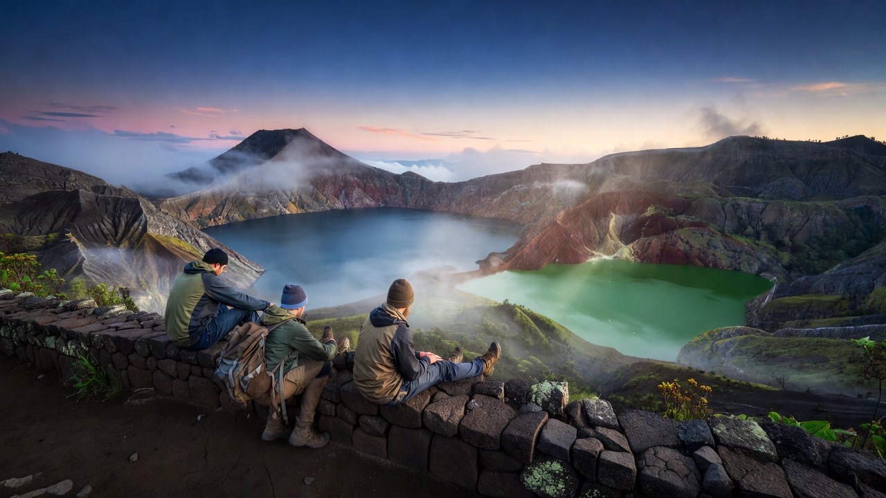 Flores, Indonesia • 1,639m